What is Rally for Rivers?

Sadhguru launched Rally for Rivers (RFR), a movement to save India’s lifelines - its rivers, on 3 September 2017.
Sadhguru personally drove over 9,300 km through 16 states to raise awareness about the dire situation of rivers.
Drawing thousands of people at 146 public events, the rally became the largest public-endorsed, mass awareness campaign in history.
Supported by over 162 million people, Rally for Rivers is the world’s largest ecological movement today.
What is Happening to Our Rivers?
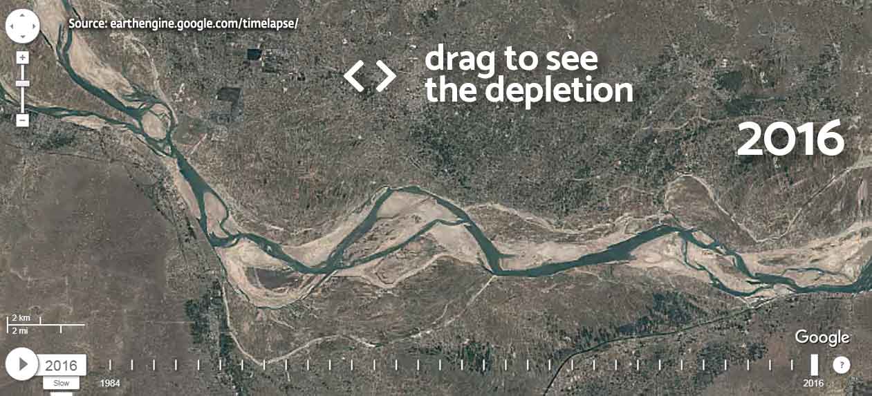
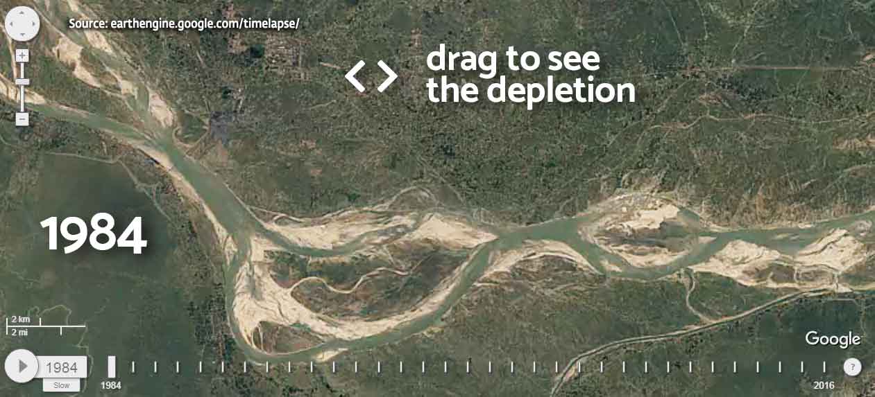
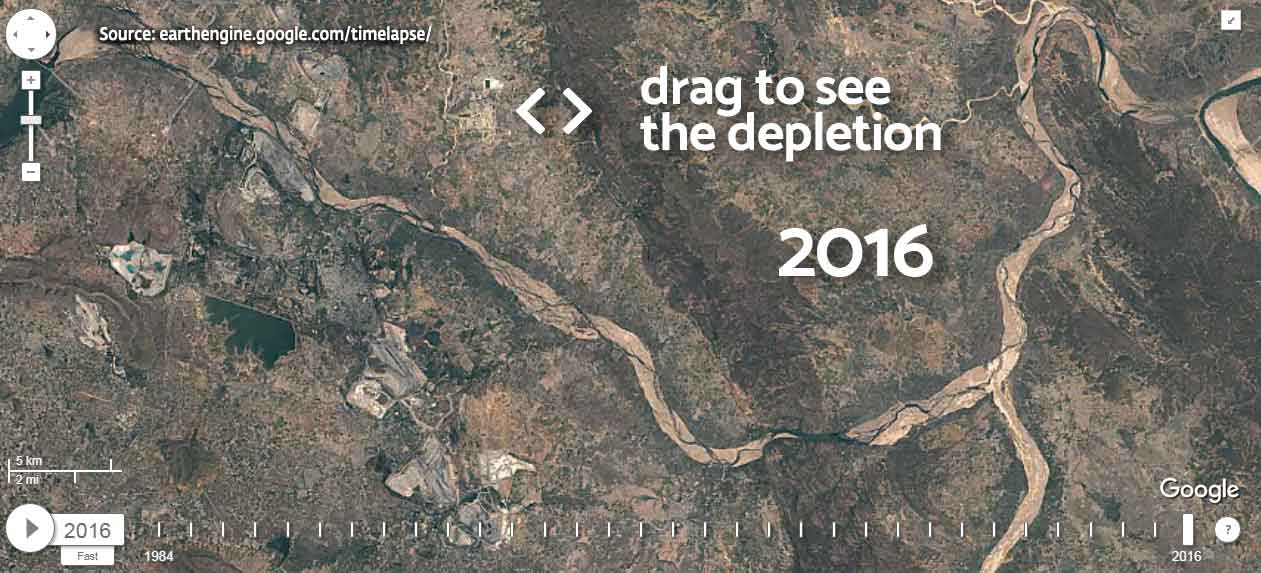
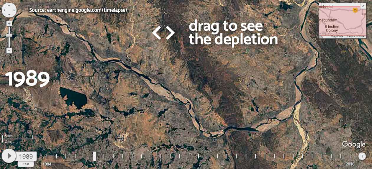
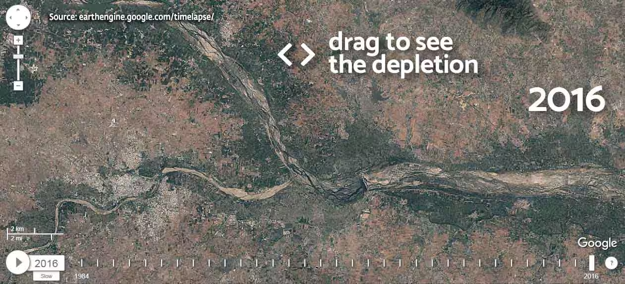
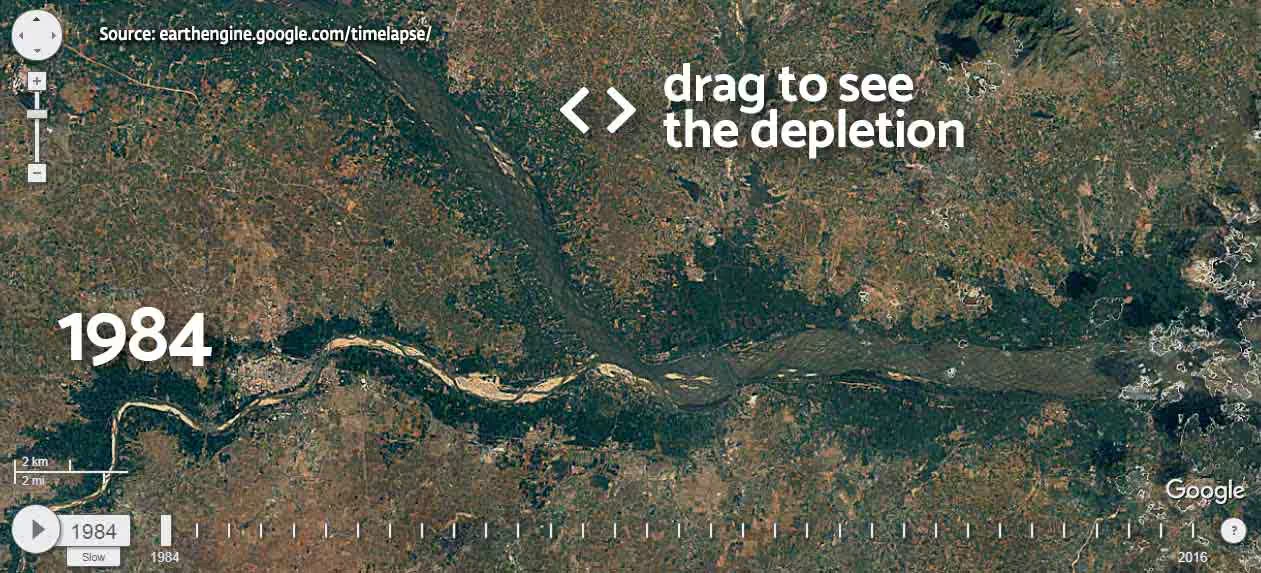
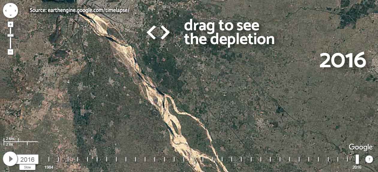
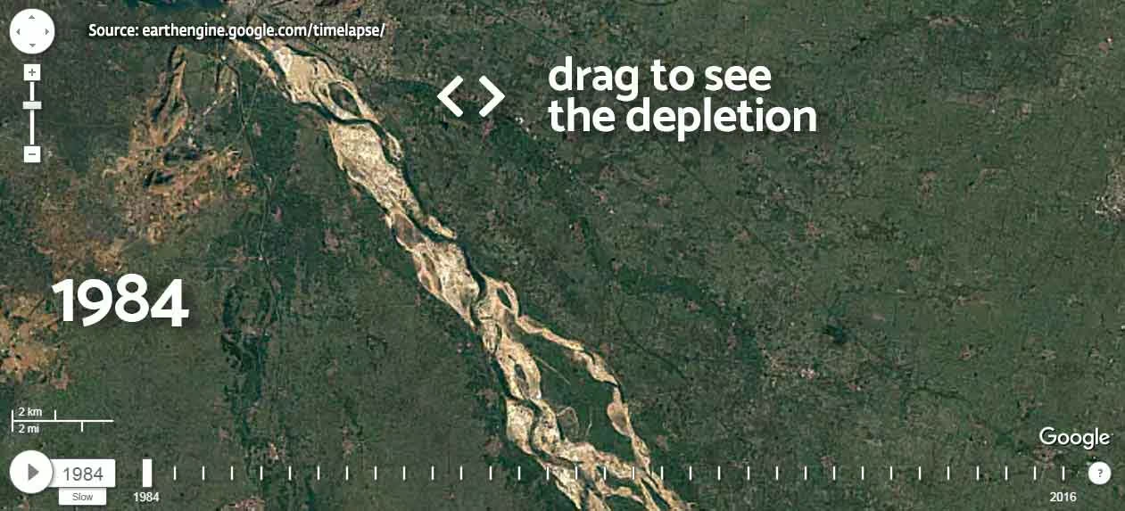
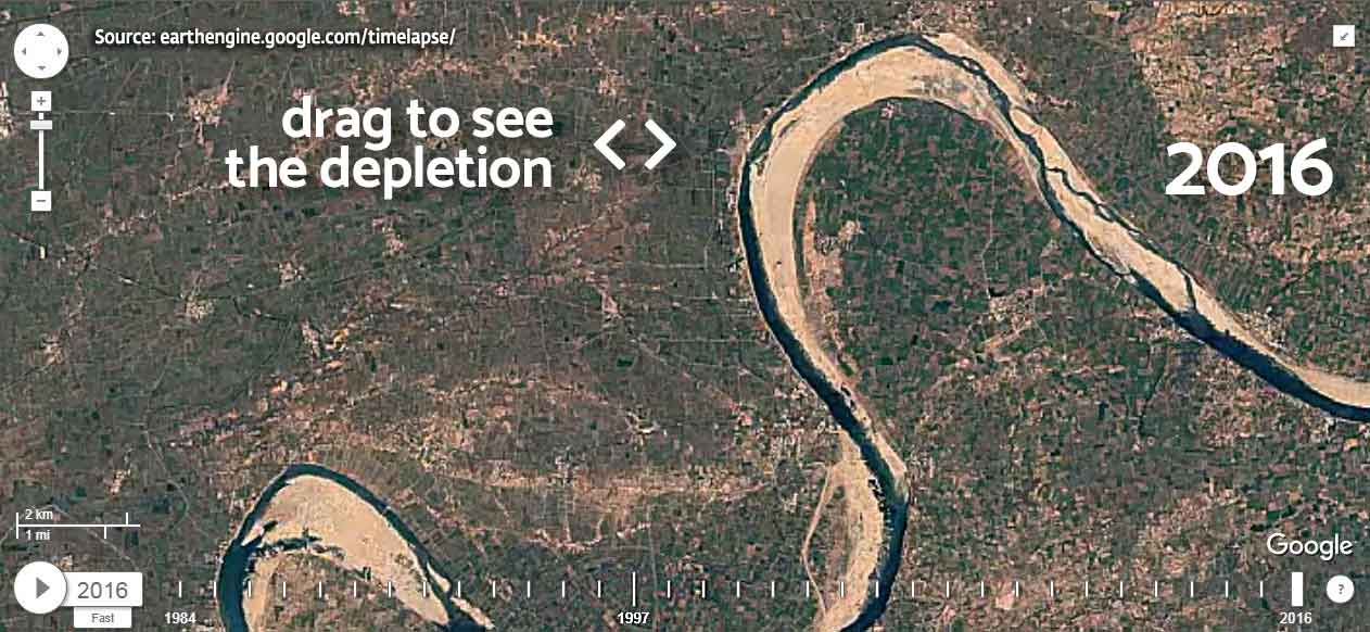
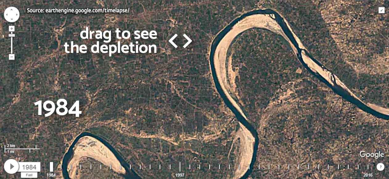
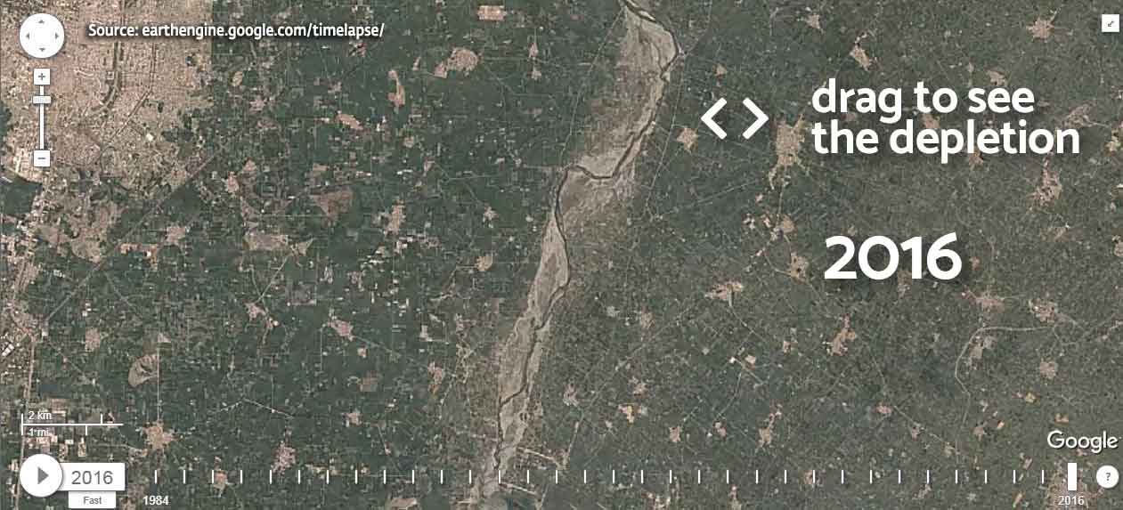
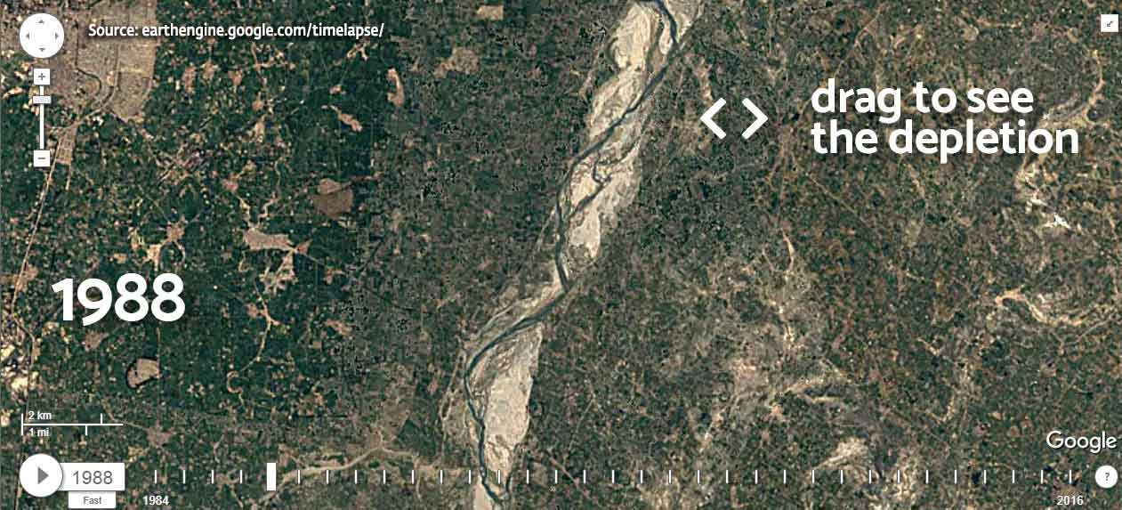
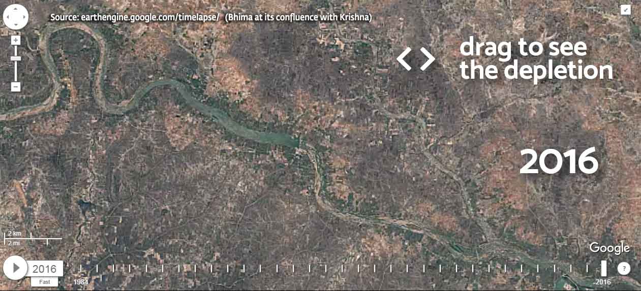
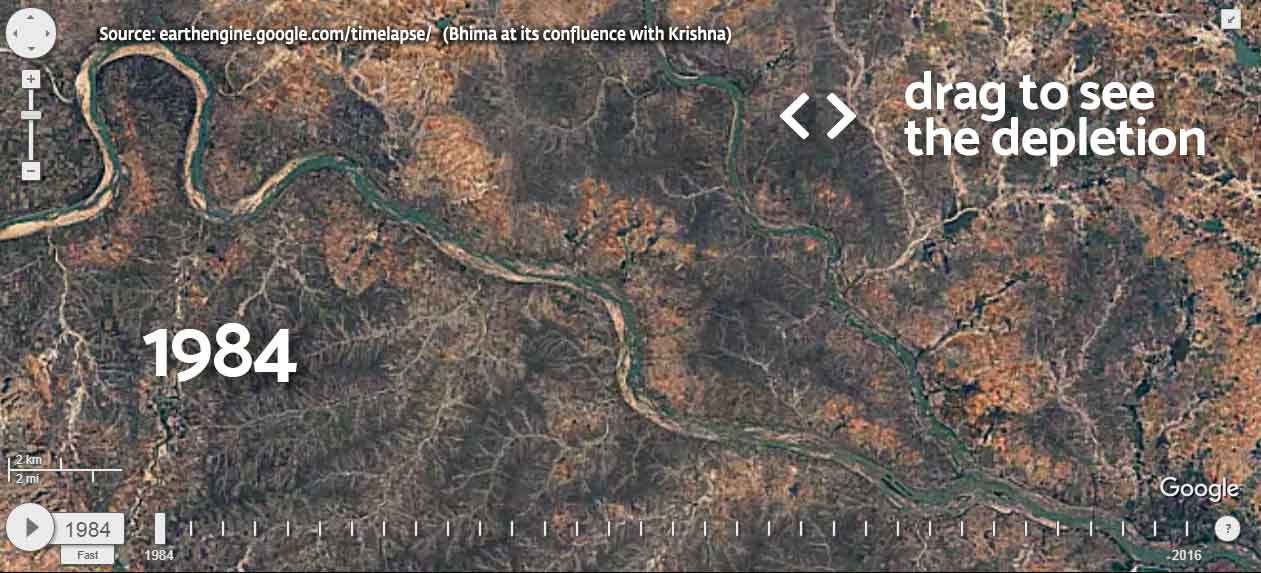
India’s rivers are undergoing a drastic change. Due to the pressures of population and development, our perennial rivers are becoming seasonal. Many of the smaller rivers have already vanished. Floods as well as droughts are becoming increasingly frequent, as rivers turn unruly during the monsoon, and vanish once the rainy season is over.
Ganga
Godavari
Cauvery
Krishna
Narmada
Yamuna
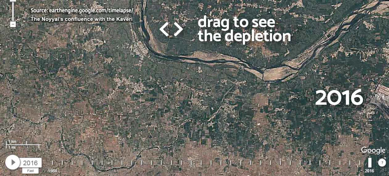
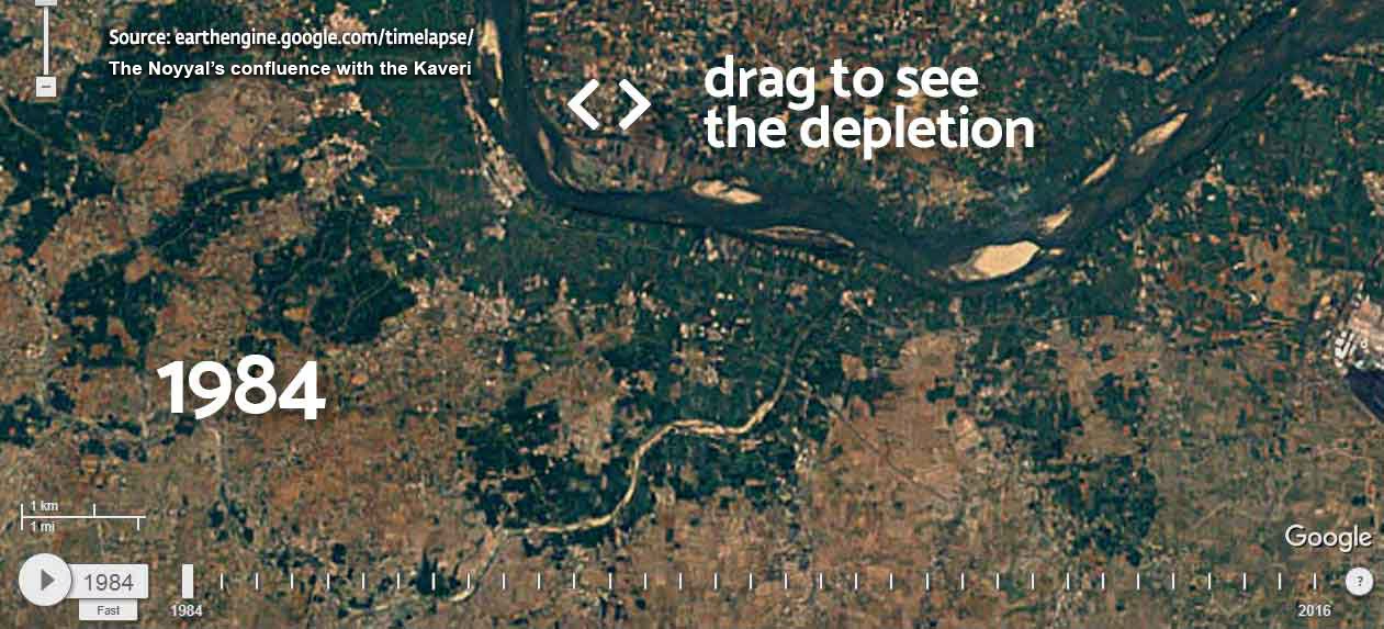
Noyyal
Musi
Bhima
Ganga
1 / 9
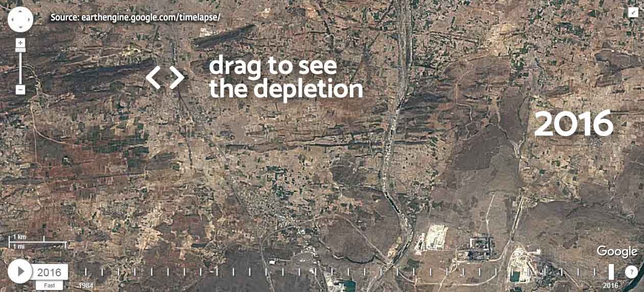
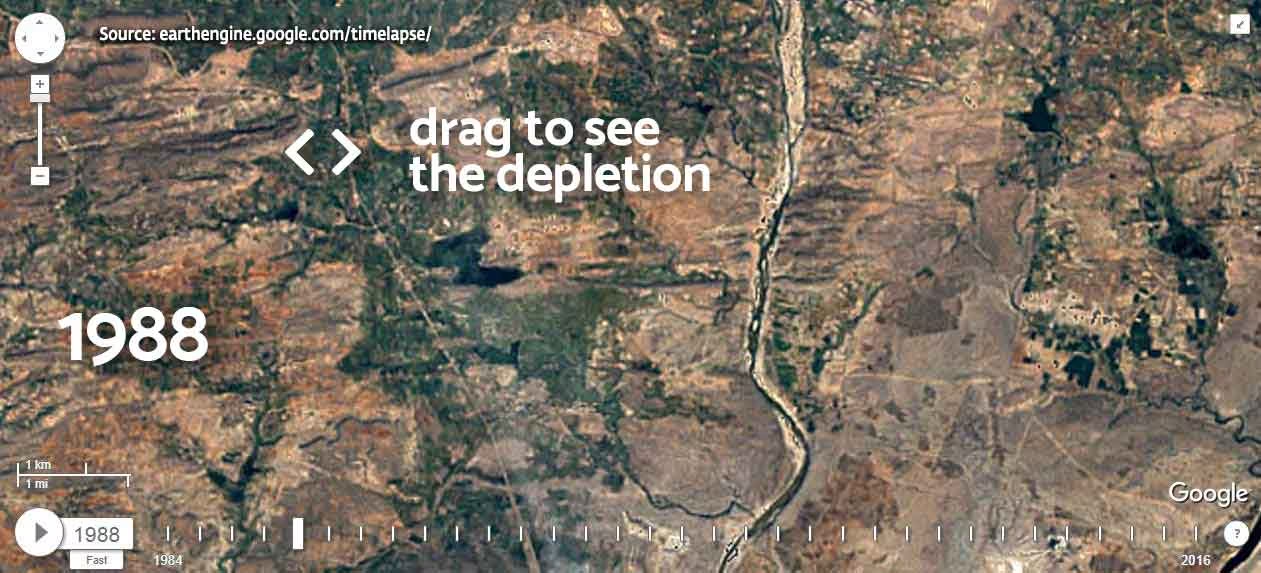
River Depletion
How This Affects Us
Estimates say 65% of our water needs are met by rivers.
2 out of 3 major Indian cities already deal with daily water shortage. Many urban residents pay ten times the normal amount for a can of water.
Water is not just used for drinking or domestic purposes. 80% of water is used to grow our food. The water requirement per person on an average is 1.1 million liters per year.
Climate change is expected to cause worse floods and droughts in the next 25-50 years, with rivers flooding during the monsoon followed by drought for the rest of the year. These trends have already begun.
How is Your State Affected?
This is a crisis affecting the entire nation. Some snapshots from across the country: The situation is grim. But with a comprehensive policy and resolute government action, our rivers can be nurtured so that they nourish future generations as well. Read more about the proposed solution to revitalize our rivers.
How Can We Save Our Rivers?
India’s rivers are mainly rain-fed. So how do they flow throughout the year, even in the dry season? Because of forests. Trees are important in ensuring that perennial rivers flow even when the rains end.
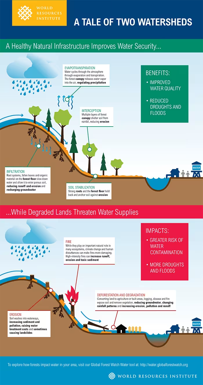
Tree roots make the soil porous so that it can absorb rain and hold water when rain falls. This water in the soil is then released into the river gradually throughout the year.
If there are no trees, a destructive cycle of floods and droughts occur. During the monsoon, excess water will flow over the surface and cause floods because the soil does not absorb the rainwater. When the monsoon ends, rivers go dry because there is no moisture in the soil to feed them. This is why it is important to maintain substantial tree cover along riversides.
Impact of RFR
Sadhguru's 9,300 km drive: 162M pledges
In 2017, Sadhguru drove 9,300 kilometers across 16 states, from the southern tip of India to the Himalayas, conducting 146 events and over 700 media interactions. An incredible 162 million people pledged their support in just 30 days.
RFR Adopted As National Policy
Based on RFR recommendations, NITI Aayog (Indian government's policy think tank) issued a National River Revitalization Advisory to all the 29 states and 7 UTs.
India Commits to Revitalize 13 Rivers
The Government of India announced plans to rejuvenate 13 major rivers by announcing a budget of INR 190 billion. These projects are in line with the RFR draft policy recommendations given to Prime Minister Shri Narendra Modi by Sadhguru in 2017.
Cauvery Calling: On-ground Implementation of RFR
The Rally for Rivers recommendation aims to drive a change from an engineering-based approach to a nature-based approach for river revitalization.
The Cauvery Calling initiative was launched as a large-scale river revitalization model, based on the RFR policy recommendation, that can be replicated across the tropical world. To date, over 108 million living trees have been planted as part of this effort to rejuvenate the Cauvery region.
Awards & Recognitions